File:Carte - États fédérés (Lands) d'Allemagne.png: Difference between revisions
From Wikimini Stock
Jump to navigation
Jump to search
(Carte des États fédérés d'Allemagne Source : [http://fr.wikipedia.org/wiki/Fichier:Map_Germany_L%C3%A4nder-fr.svg]) |
No edit summary |
||
| Line 1: | Line 1: | ||
Carte des [[ |
Carte des [[État fédéré (Allemagne)|États fédérés]] d'[[Allemagne]] |
||
Source |
Source : [http://fr.wikipedia.org/wiki/Fichier:Map_Germany_L%C3%A4nder-fr.svg] |
||
Latest revision as of 18:12, 21 September 2012
Carte des États fédérés d'Allemagne
Source : [1]
File history
Click on a date/time to view the file as it appeared at that time.
| Date/Time | Thumbnail | Dimensions | User | Comment | |
|---|---|---|---|---|---|
| current | 17:57, 21 September 2012 | 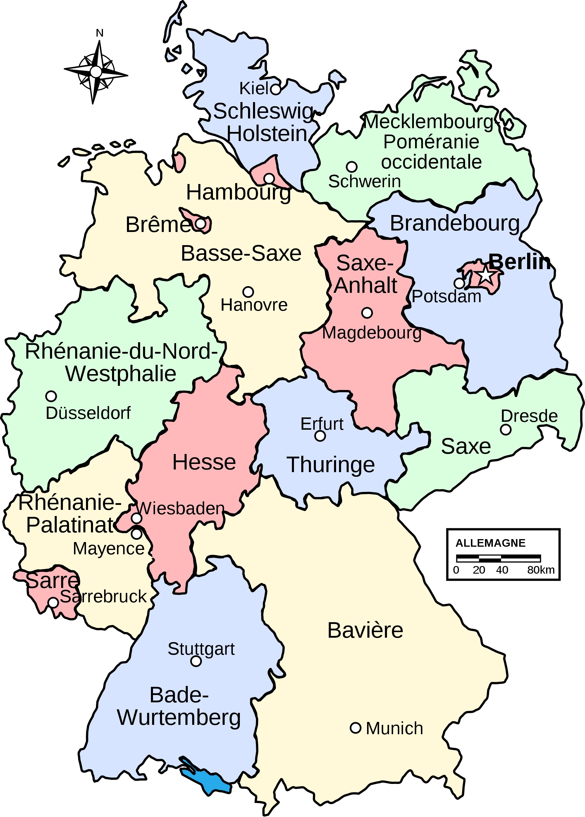 | 2,000 × 2,793 (708 KB) | Jereemy (talk | contribs) | Carte des États fédérés d'Allemagne Source : [http://fr.wikipedia.org/wiki/Fichier:Map_Germany_L%C3%A4nder-fr.svg] |
You cannot overwrite this file.
File usage
There are no pages on the Stock that use this file.
Check on:
- Encyclopedias
- Wikimini ES (Wikimini en español)
- Wikimini FR (Wikimini en français)
- Wikimini SV (Wikimini på svenska)
- Other


 Views
Views

 Tools
Tools 


 Personal tools


_d%27Allemagne.png&action=edit&redlink=1)
_d%27Allemagne.png&action=history)
_d%27Allemagne.png&oldid=131924)
_d%27Allemagne.png&action=edit&oldid=131924)
_d%27Allemagne.png&oldid=131946)
_d%27Allemagne.png&action=edit)
_d%27Allemagne.png#filelinks)
_d%27Allemagne.png#filelinks)
_d%27Allemagne.png#filelinks)
_d%27Allemagne.png#filelinks)
_d%27Allemagne.png)